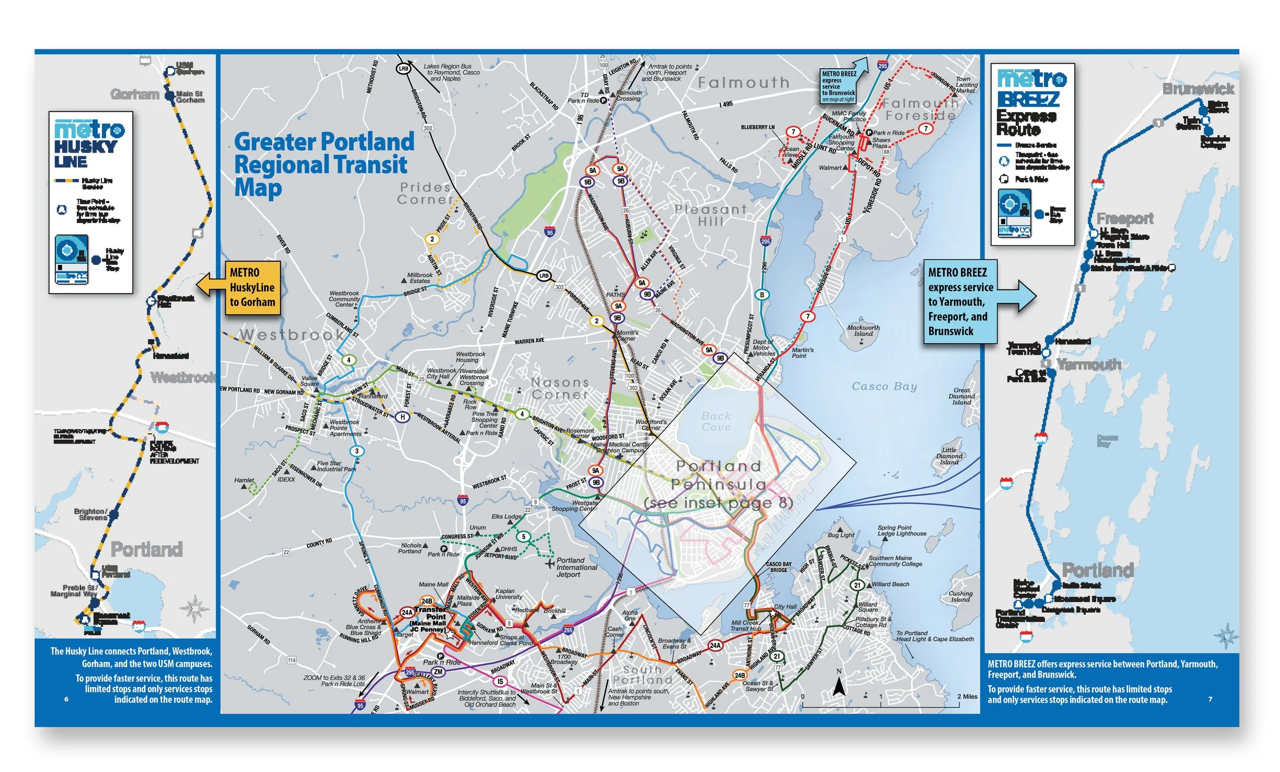
I have developed a variety of maps and guides for conservation and transit organizations. Sometimes they were formatted like a booklet. Other times they worked best as multi-folded pieces, with some small enough so the user or hiker can tuck it into their pocket while on the trail. Maps were developed using a GIS base map, then detailed, stylized and enhanced in Adobe Illustrator and Adobe Indesign. Most of the maps I create are computer generated, however I have been lucky enough to be able to create ones that are illustrative and hand drawn.

m a p s a n d g u i d e s


Greater Portland Metro Bus
Gateway to Maine: Outside
Great Works Regional Land Trust
Kennebunk Land Trust
South Portland Bus Service
Mt. Agamenticus Conservation Region
Kittery Land Trust